phargam an trek

Phargam An Trek

from
$1,000

Phargam An Trek: A difficult high-altitude trek in Pakistan that connects Golen Gol with the Laspur Valley, giving beautiful mountain views and rugged terrain to adventure enthusiasts

  • Reviews 0 Reviews
    0/5
  • Vacation Style Holiday Type
    Camping, Climbing, Guided, Hiking, Mountaineering, Trekking
  • Activity Level Moderate
    3/8
  • Group Size Medium Group
    20
All about the Phargam An Trek.

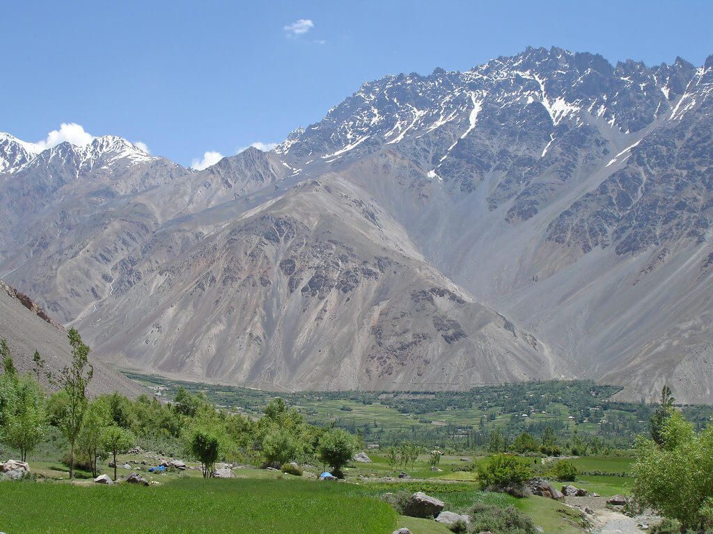
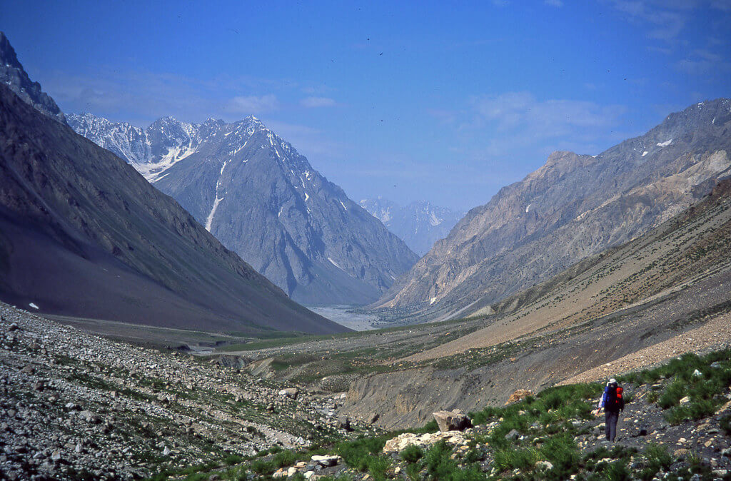
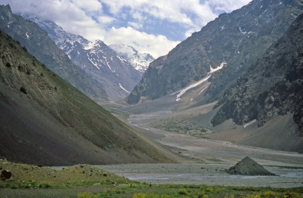
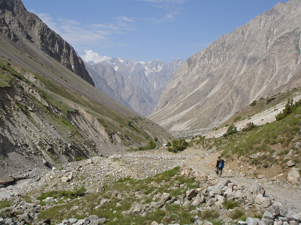
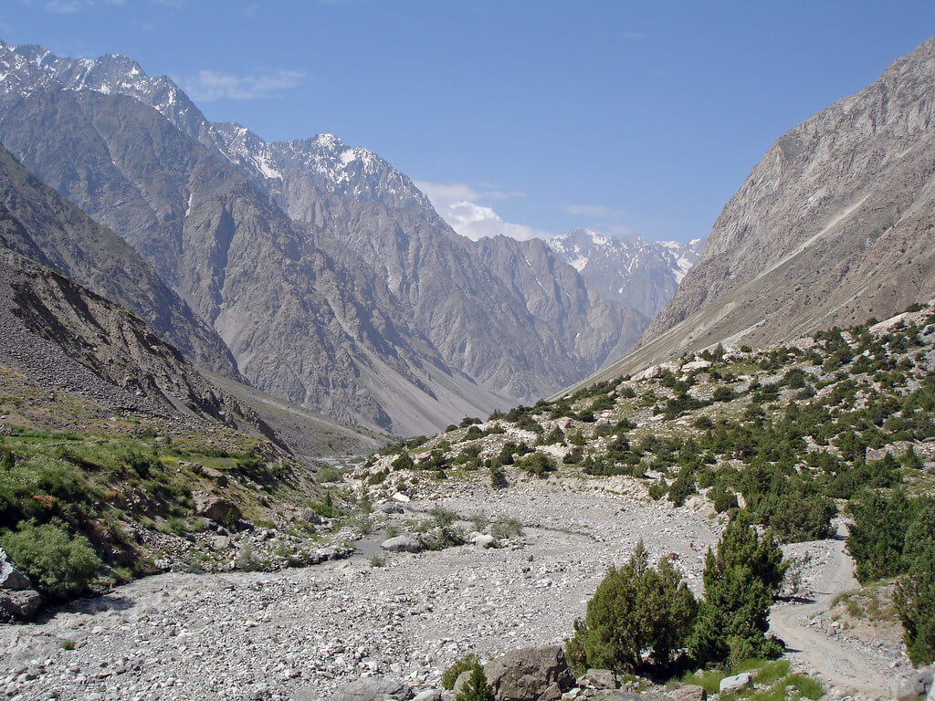
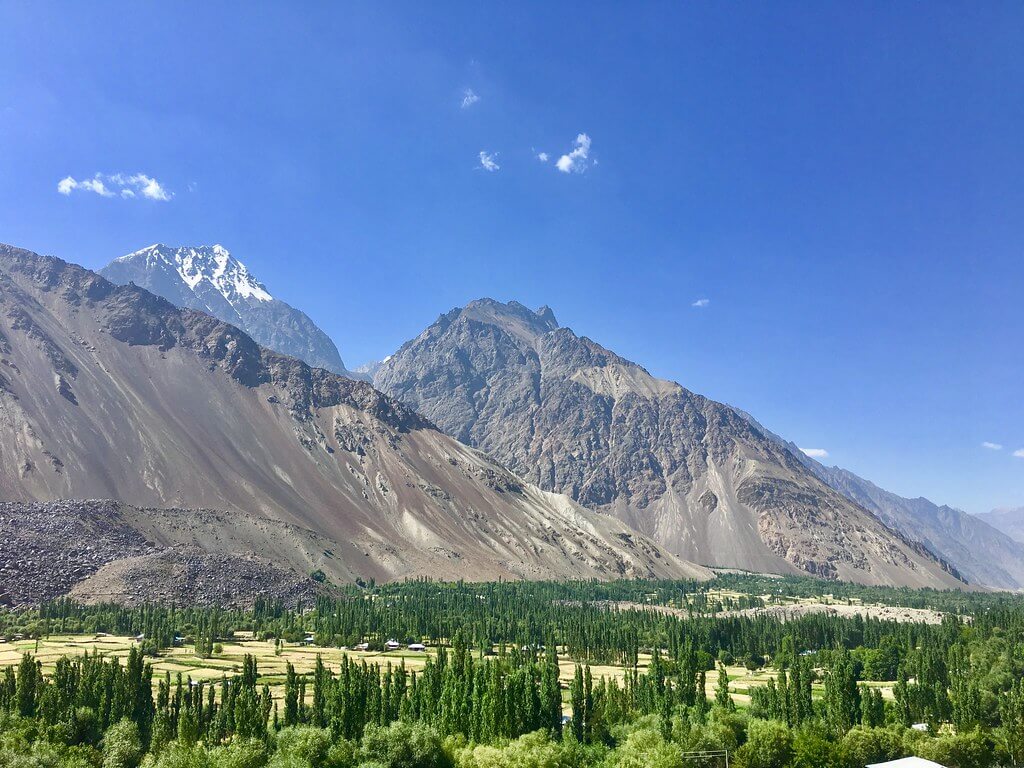
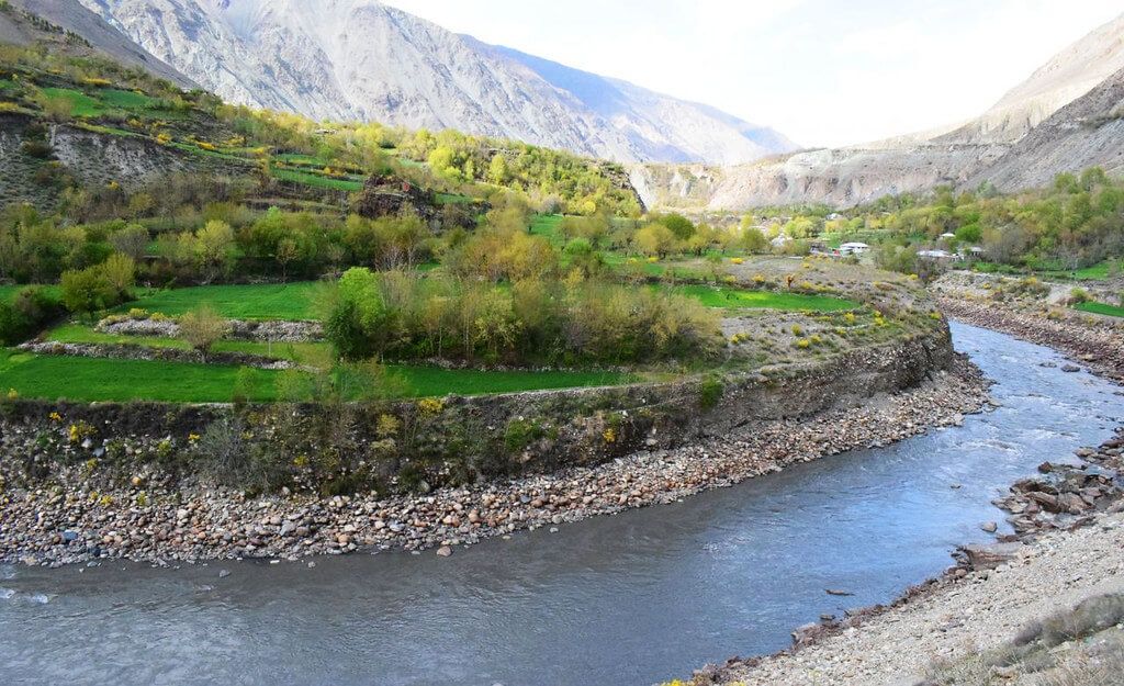
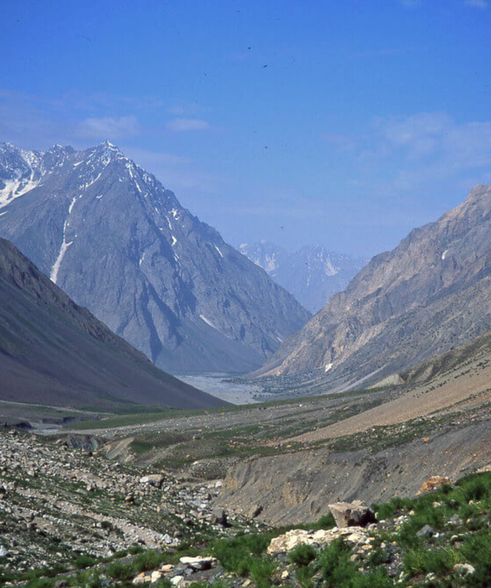
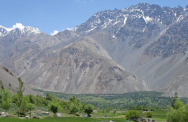
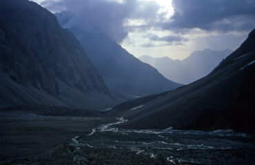
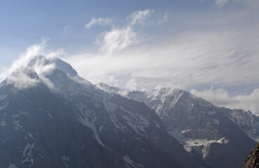
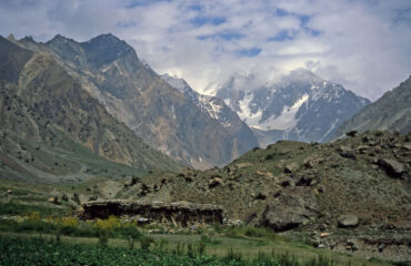
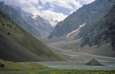
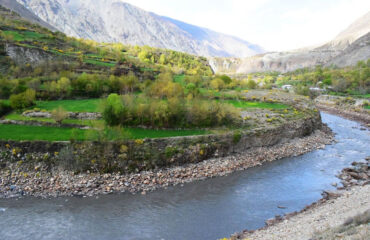
Phargam An, a pass located at a height of 4,975 metres, connects the rarely travelled Golen Gol with the lovely Laspur Valley, which is found at the western base of the Shandur Pass. Before the Chitral-Gilgit road was built, this ancient route served as a crucial summertime passageway. Trekkers are rewarded with the breathtaking sights of the soaring Buni Zom and Ghuchhar Sar peaks as they set out on the journey through Phargam An.

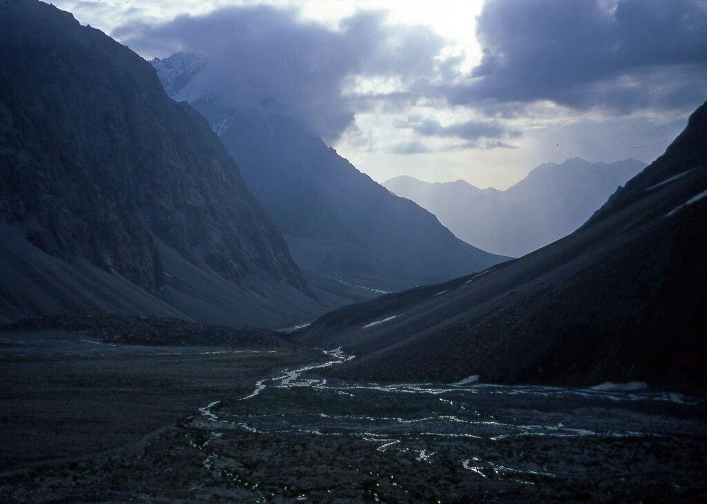
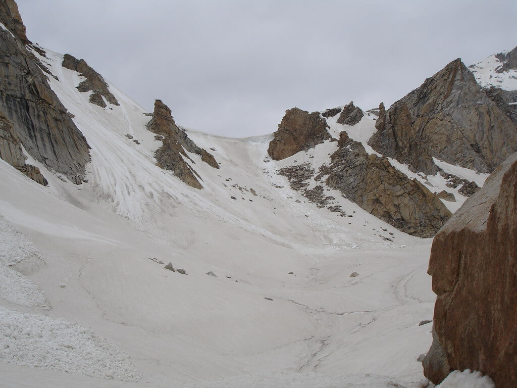
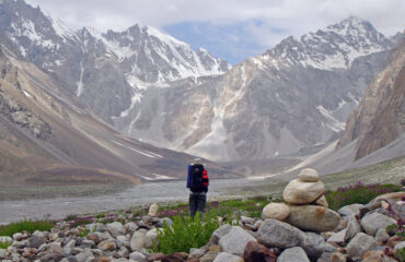
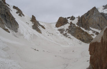
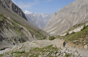
A difficult expedition that requires several hours of Class 2 climbing is trekking through Phargam An. Along this lesser-known trail, hikers must negotiate enormous talus slopes, and their ability to choose the appropriate path becomes essential. This journey is perfect for people who enjoy exploring and are willing to take on the obstacles that come with it because of the steep and rough terrain.

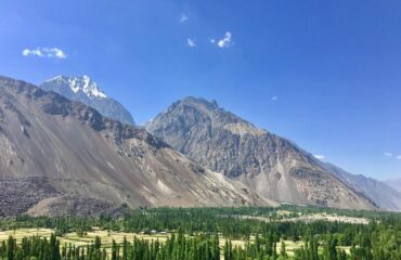
This trek’s historical importance is what gives it its special charm. Phargam An, which allowed trade and transport between Golen Gol and the Laspur Valley, was formerly a lifeline for the nearby communities. It offers modern travellers the chance to travel in the footsteps of those who have travelled this route in the past.

Trekkers are rewarded with expansive panoramic views of the surrounding countryside as they ascend the pass. The Buni Zom and Ghuchhar Sar peaks’ bare and untamed beauty contrasted with the tranquil valleys below.

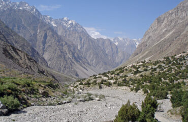
A reminder of the natural wildness that survives in these far-flung areas of the planet, it is a time of great connection with the untamed, pristine nature of this area.

Phargam An attracts people looking for an adventure off the beaten route, offering them to discover landscapes that have not yet been influenced by the contemporary world. It offers a chance to test one’s physical and mental limits while taking in the unadulterated beauty of the natural environment. This walk offers a trip back in time and a profound connection with the untamed landscapes of Golen Gol and the Laspur Valley for those with an adventurous attitude.

  1. Day 01 Istor to Chhatar Ghuni

    The name of the tallest settlement in Golen Gol, Istor (2700m), in Khowar is ”horse.” A spring and a grassy, shady camp spot are located across the river from Istor. In order to reach Romen, a level location with cottages, pastures, and clear springs, the trail up Golen Gol narrows and continues for 5 kilometers. A large, grassy plain with crystal-clear streams, a few houses, and some farmland is reached after another 2.5 miles. Maps refer to this as Chhatar Ghuni (3000m), but the locals name it Jungal. From Jungal, the Lohigal Gol branches south to the Lohigal An.

  2. Day 02 Chhatar Ghuni to Jeshtanan Camp

    The Gujar huts of Dangari Kuru (3150m) are located a short 5 km beyond Chhatar Ghuni. From here, a side valley named Sachiokuh Gol leads to Sor Laspur via the Bashqar Gol and a pass to the south and east, respectively. This unidentified pass is incorrectly depicted on the U502 Churrai (NI 43- 1) map. The pass is higher (at 5070m) and entirely covered in glaciers. Trekkers cannot complete it because of the difficult glaciated ascent and descent with major crevasses.

    The Gujar huts of Dukadaki are situated one kilometer beyond Dangari Kuru. The Mastuj River is followed northward from Dukadaki via a 4633-meter pass to Reshun on the U502 Mastuj (NJ 43–13) map.  This steep trail, which appears to be no longer used, is unknown to the people of Golen or Reshun. The huts of Chakoli Bokht (3600m), where the Golen Gol inhabitants manage their sheep and goats, are located about 5 km beyond Dukadaki in a stony desolate region. Here, springs emerge from the cliff’s base, and talus-covered hills surround a small patch of grass.

    Beyond the last patch of grass at Chakoli Bokht, proceed north towards the cliffs at the foot of the Golen Glacier by navigating the talus fields and two side streams. Reach Jeshtanan camp (4050m), a group of three little stone huts perched against a cliff 6 kilometers from Chakoli Bokht. The area around this gorgeous camp, albeit occasionally windy, has wonderful, pure water. Locals claim that jeshtan spirits occasionally appear here. They are tiny creatures around the size of children, and all they are dressed in is a juniper-wood-colored small, pointed cap. The name is derived from the Sanskrit word jyestah, which means first or eldest and is cognate with the Kalashamun term jestak.

  3. Day 03 Jeshtanan camp to Phargam High camp

    Along the true right (north) bank of the outwash stream of the Golen Glacier, climb the lateral moraine. On the moraine, a little patchy grass grows, but the path is steep and covered in talus. Arrive at the summit of the ascent between one and two hours from camp. Turn left 40 degrees and climb an unlikely-looking talus slope at the point where the path levels off, with a black moraine ahead and a green hillock on the right. A beautiful grassy region with abundant wildflowers and snowcocks can be reached by ascending enormous Class 2 granite boulders for one to 112 hours. From here, gradually ascent talus will take you to the pass. You might come upon the remains of an ancient trail that a former Mehtar of Chitral used to ride his horse over. The old trail is completely lost on the last hard ascent to the pass until just before the summit when water and the trail are once more visible. Reaching Phargam An (4975m) takes anything between four and six hours. A metal plaque honoring an Australian mountaineer who casually hiked to the top and now sleeps in the glacier, Gorge Kronberger, is located on a cairn there.

    Through mid-August, the pass should still have some snow on it and have a small cornice on its northern side. Until you reach grassy, flower-stream ibex habitat, the descent is made via talus, where you may occasionally come upon the old track. Snow leopards are undoubtedly present as well, despite being rarely sighted. If you start early the following morning, you can camp here and still make it to Harchin in one long day.

    A rocky hill lies just beyond this location. Leaving it to the left, turn right and descend a scree slope. The historic route and crystal-clear streams are seen below. On a hot day, the stream is calm and clean and invites you to wash the dust from your hair under a waterfall. There are also many flowers and low-willow trees in the area. Enter the upper Phargam Gol with its rocky, precipitous cliffs. A magnificent waterfall that originates from Buni Zom’s Khora Bort Glacier blossoms to your left to the north. Only early in the morning on hot days is it possible to cross the river from this enormous waterfall. Large rocks roll down the riverbed in the afternoon, making it impossible to cross. Three to four hours from the pass, camp at Phargam High Camp (3900m) in a grassy meadow surrounded by clear streams before the river. Enjoy the sunset over this beautiful upper valley’s cliffs and mountains.

    Here is the base camp for climbers attempting Buni Zom, which was originally scaled by a New Zealand team in 1957. The Khora Bort Glacier and Khora Bort Zom (5850m), as well as the path to Buni Zom, are reached by a small, steep gully with loose rocks close to Gulabmali. It is wise to use a climbing helmet. A steep moraine leads to a snowy basin beyond the gorge, where you can set up camp. A local guide is required because the route forks and is perplexing above the basin. Panorama Peak (5690m), a nearby mountain, provides superb vistas for less aggressive climbers.

  4. Day 04 Phargam High camp to Harchin

    The river is chilly and milky white in the morning instead of muddy brown, making it simple to cross. As you descend, you will pass magnificent hanging glaciers on both sides of Phargam Gol as you cross another glacial side stream and join the trail that leads down the valley. A small spring and an unpaved road connect the settlement of Phargam with Rahman. Jeeps are scarce, thus you must travel by foot along the true left (west) bank of the Laspur River to Rahman and then cross a bridge to get to Harchin (3000 meters) on the Gilgit-Chitral route.

Package Confirmed Dates Trip Status Trip Status Price (PP) Excluding Flights Price (PP) Including Flights  
June 12, 2025 - June 19, 2025
Guaranteed
$1,000
N/A