owir an trek

Owir An Trek

from
$1,000

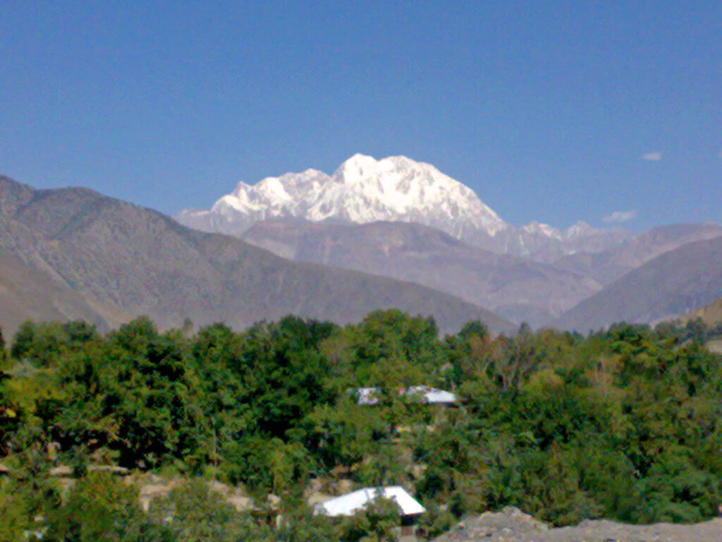
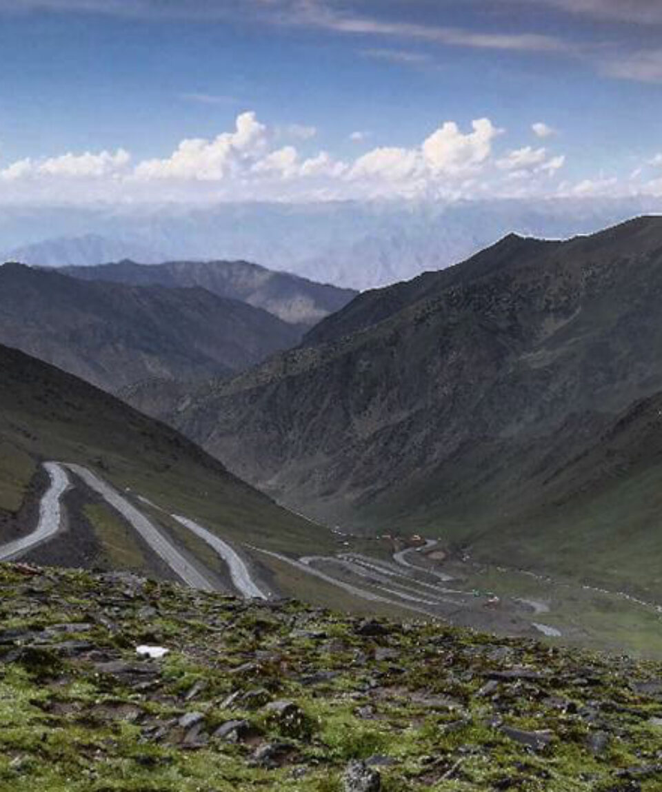
The Owir An Trek provides breathtaking views of Tirich Mir’s southern flanks. It’s a short, popular walk that begins in Ojhor and is great for visitors looking for rapid mountain sights

  • Reviews 0 Reviews
    0/5
  • Vacation Style Holiday Type
    Camping, Climbing, Guided, History, Mountaineering, Trekking
  • Activity Level Moderate
    3/8
  • Group Size Medium Group
    20
All about the Owir An Trek.

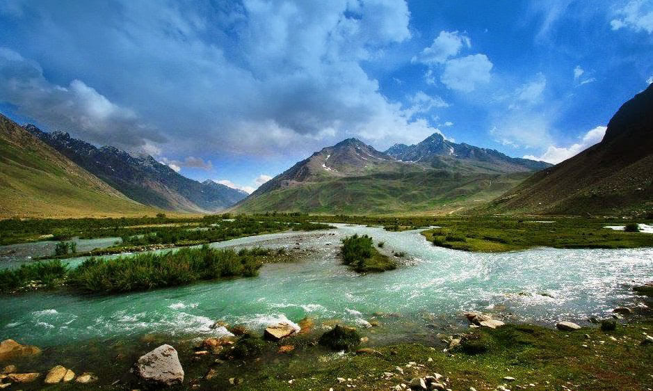
The Owir An trek offers an easily accessible and well-liked adventure that winds over the southern slopes of this impressive peak, nestled in the center of the spectacular Tirich Mir massif. Trekkers passing through this area are welcomed by welcoming settlements, each with its own special charm, making for a wonderful journey across the area’s untamed splendor.

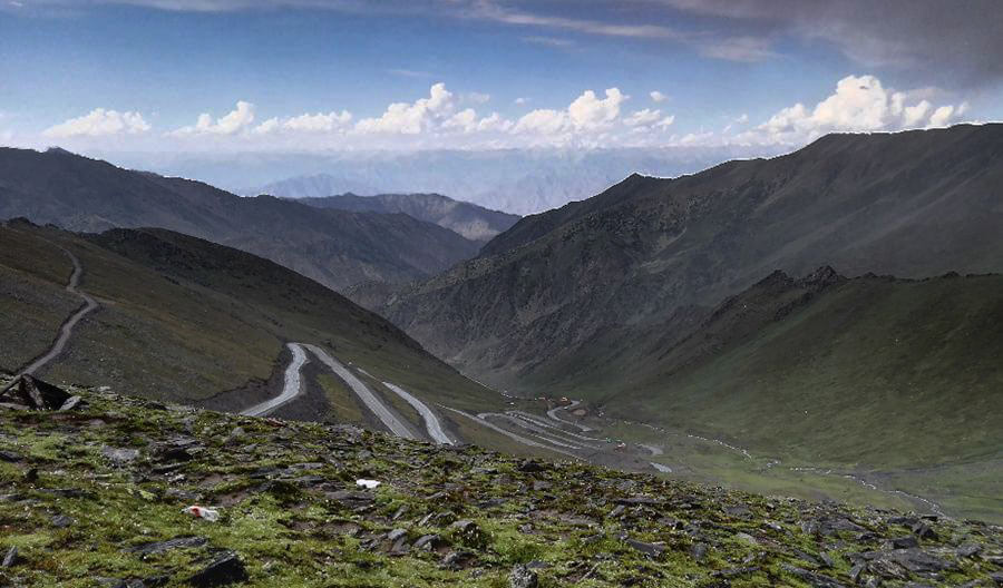
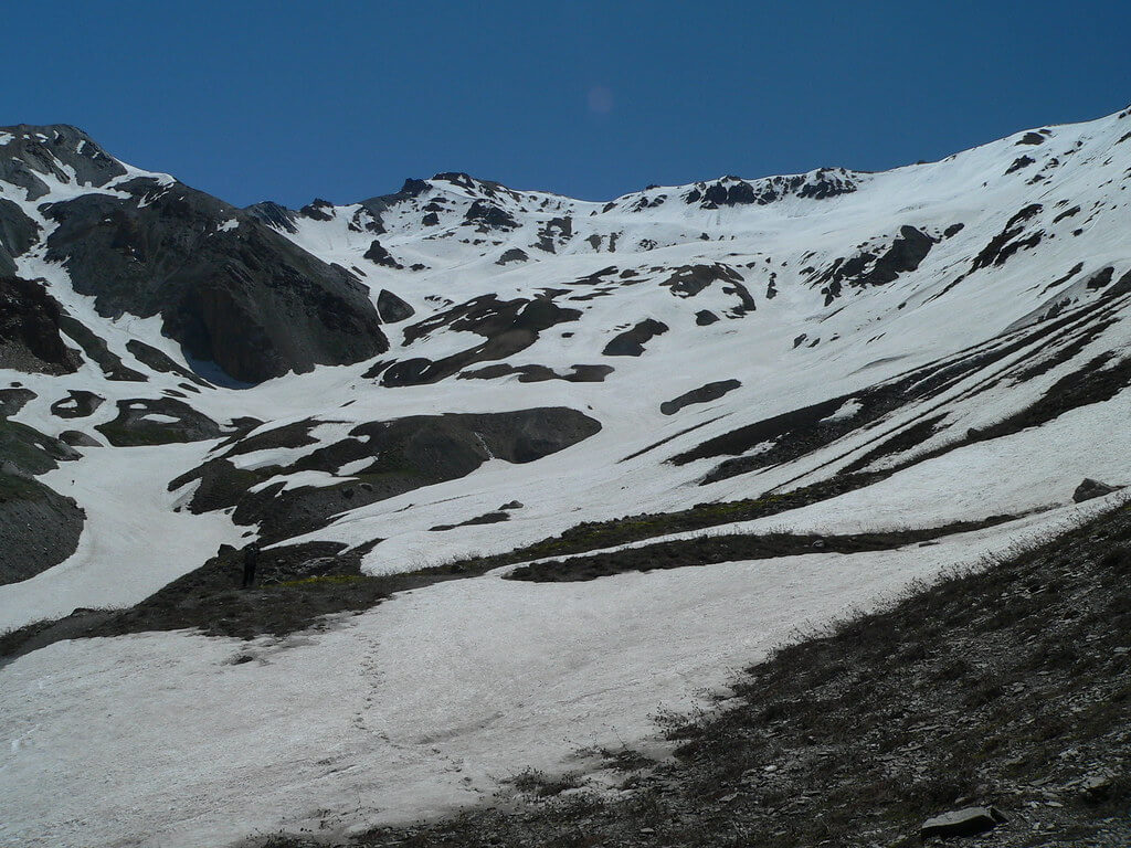
The highest point of this brief but thrilling trek is Owir An, which is located at a height of 4337 meters. This path stands out because it gives hikers a chance to see the breathtaking southern flanks of the Tirich Mir massif up close. The journey can be made from Ojhor, located southwest of Tirich Mir, to Owir, located southeast, or vice versa.

The journey promises a close-up contact with the remarkable landscapes of the area, with each step highlighting the Karakoram’s natural splendor. Owir An offers a glimpse into this region’s vast wildness, with its verdant valleys and craggy peaks.

Trekkers have the ability to interact with the friendly and welcoming folks who call this region home as they navigate this spectacular terrain. It’s a walk that provides both a chance to commune with nature and become immersed in the region’s rich cultural heritage.

Owir An serves as a reminder that excitement and beauty don’t have to be far-off ideals but may instead be enjoyed in the present. Trekkers will return with priceless memories of a journey that was well worth going on if they accept the call to discover, connect with, and be enthralled by the wonders of the Karakoram.

  1. Day 01 Shahguch to Kiyar High camp

    The villages of Sussoom (2896m) and Kiyar are divided by Ojhor Gol. Lasht is located on its actual right bank. Just upstream from the bridge, between the two settlements, is Shahguch, a sizable, well-watered grassy meadow. Set your camp in Shahguch (3000m) before continuing your ascent. Follow the route for 15 minutes to reach Kiyar from Shahguch. Turn left and take a trail up through fields from Kiyar’s polo field. As you move towards the highest trees and fields, keep the obvious dry, stony spur with a small cairn to your left. Three vertical rock outcrops and a waterfall valley are on your right, but farther away. Reach the highest fields and residences, then continue on the trail for one hour from Kiyar, crossing a dry, rocky spur on your left to reach the saddle. Excellent views of upper Ojhor Gol and Tirich Mir may be seen from this vantage point. From the saddle, slowly contour up the east side of the Ojhor Gol for 45–1 hour, crossing a few tiny, clear streams along the way to Kiyar High Camp (3500m), a protected, level spot with space for numerous tents.

  2. Day 02 Kiyar High Camp to Owir High Camp

    After 15 minutes, the trail reaches a ridge and swings east to climb the south side of the valley that leads to the pass. Follow the snowpack at the meeting of two minor streams for about 30 minutes. The northern (left) side of the steep cliffs above is where the ascent to the Owir An begins. In 30 minutes, climb up to the gully with a tiny stream on the left of the rocky outcrop from the snowfield. The climb to the pass itself takes one to eleven and a half hours from here. Immediately to the left of Owir An (4337m) is a little black outcrop. A snowfield can be seen on both sides of the pass during years with a lot of snowfall or early in the season. The Buni Zom mountain dominates the view from the pass, while the Shandur range can be seen in the distance. Below, you can see Shungush’s fields.

    Follow the little creek as you descend, crossing a little side stream on the left. Well above the real left side of the mainstream, the trail descends a ridge. Arrive at the confluence of two streams, a level region with some grass and a few campsites, one hour from the pass. From here, a different trail leads to the Barum Glacier (see the alternate Finish).

    Alternative Finish: Kiyar High Camp to Shahbronz 

    Follow the steep ridge trail up when hiking in the reserve direction from Owir High Camp to the pass. Before you reach the ridgetop, above the real left bank of the stream below, the pass is not visible. A tiny hill with a noticeable squared-off rock outcrop to the south (left) is discernible ahead as the route and the stream approach one another. Just to the north of this hill is the Owir An.

    Follow the trail that crosses to the true right bank of the major stream and continues 45 minutes later via undulating hills and grassland to another stream and a sizable grassy space if you want to continue towards Mujhen. At the base of a rock outcrop, close to a little pool, is Large Owir High Camp (4178m).

  3. Day 03 Owir High Camp to Mujhen

    Cross over to the east bank of the creek and proceed down a deserted canal. As you leave camp, you can see the square-topped outcrop and tiny hill that serve as Owir An’s landmark. The trail contours around a number of ridges. The view from Tirich Mir is breathtaking. One hour from the High camp, contour to a ridge with views of farmland and homes, then drop to the upper settlement. To reach Mujhen (2927m), take the wide trail through the village for one hour.

    Alternative Finish: Kiyar High Camp to Shahbronz

    As you travel along this route, you will Shukushal and have the choice to keep on to Tirich Mir Base Camp. 

  4. Alternative Day 02 Kiyar to High Camp to Gologar

    Follow the trail following the true left bank of the mainstream for 30 minutes to get to the grassy meadow known as Gologari (4200m) from the level grassy area with a few tent sites an hour below (east of) the pass.

  5. Alternative Day 03 Gologari to Shahbronz

    Once you reach Shahbronz (3000m), you can switch porters.

  6. Alternative Day 04 Shahbronz to Shukushal

    The North Barum Glacier’s terminus is close to Shukushal (3800m), the local name for Tirich Mir Base Camp, which is six hours up the Barum Gol.

     Side Trip: Tirich Mir Base Camp

    Another base camp (4700m) was used by the 1950 Norwegian expedition, the first to summit Tirich Mir, two days beyond Shukushal, along the Barum Glacier.

  7. Alternative Day 05 Shukushal to Shahbronz

    Return to Shahbronz Road from down valley.

Package Confirmed Dates Trip Status Trip Status Price (PP) Excluding Flights Price (PP) Including Flights  
June 12, 2025 - June 19, 2025
Guaranteed
$1,000
N/A