June 19, 2025 - August 9, 2025
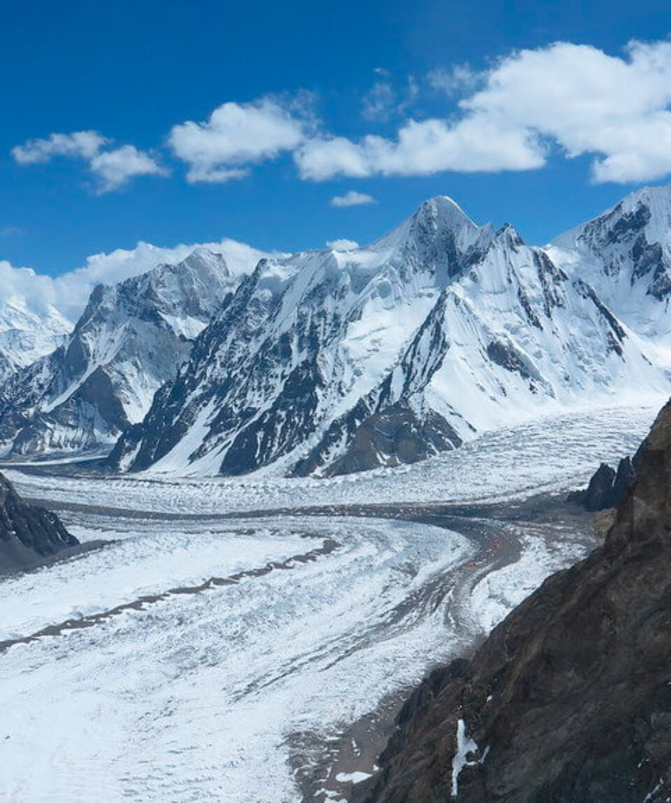
K2 Expedition – Karakoram
from
$19,700
K2 Expedition is a risky ascent to the summit of the second-highest mountain in the world, also known as “Savage Mountain.” It’s a high-altitude climbing journey in the renowned Karakoram mountain region.
-
Reviews 0 Reviews0/5
-
Vacation Style Holiday TypeCamping, Climbing, Expedition Style, Guided, Mountaineering, Rock Climbing, Trekking
-
Activity Level Challenging
-
Group Size Large Group
All about the K2 Expedition – Karakoram.
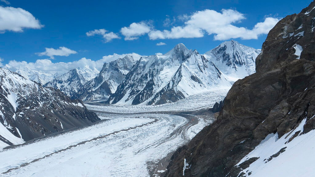
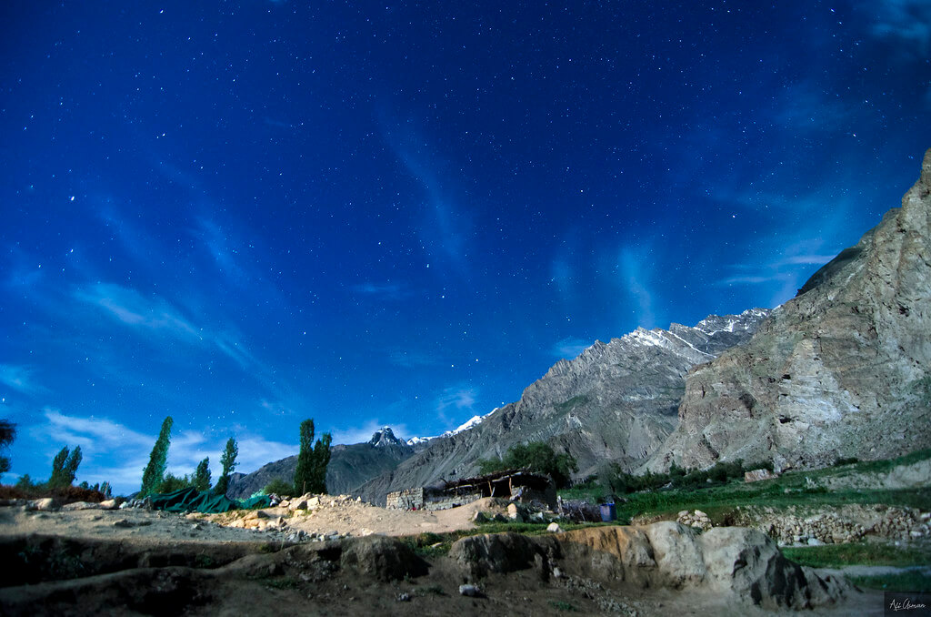
The second-highest mountain in the world, K2, commonly referred to as the “Savage Mountain,” is the goal of the treacherous and risky K2 Expedition. This adventure takes climbers through perilous terrain and harsh conditions to reach their peak in the Baltoro Glacier region of Baltistan, Pakistan.
The Abruzzi Ridge sometimes referred to as the Standard Route or Abruzzi Spur, is frequently the route chosen for the K2 Expedition. Luigi Amedeo, Duke of the Abruzzi, attempted this route for the first time in 1909, but it wasn’t until July 31, 1954, that an Italian team led by Ardito Desio succeeded in reaching the summit. Lino Lacedelli and Achille Compagnoni, the climbers who completed this achievement, left their marks on mountaineering history.
The climbers set up the Advanced Base Camp at a height of roughly 5,400 meters (17,700 feet), where the ascent begins. They then travel through a series of ice fields, granite ribs, snow slopes, and challenging rock climbing portions. Along the way, notable landmarks include the difficult “House’s Chimney” and the commanding “Black Pyramid.”
Beyond the Black Pyramid, climbers must navigate dangerous slopes that are exposed to the elements and lead to a notable feature called the “Shoulder.” They will be closer to completing the “Bottleneck” challenge after completing this section. The hanging seracs, which are enormous ice chunks suspended above, are dangerously close to this small couloir. After one of these seracs collapsed in 2001, climbers were unable to approach the summit that year and several climbers tragically perished while descending while facing falling ice chunks.
The K2 Expedition is well known for its technical challenges that even rival those of Mount Everest. This peak must be climbed with remarkable physical and mental stamina as well as highly developed mountaineering abilities. Only those who are incredibly dedicated, skilled, and have a profound respect for the mountain’s might and unpredictable nature dare to attempt this amazing achievement.
The K2 Expedition’s success in climbing Savage Mountain permanently inscribes the climbers’ names in mountaineering history. A lasting legacy for upcoming generations of adventurers, it is a monument to the unwavering human spirit and the goal of pushing boundaries.
The tour package inclusions and exclusions at a glance
What is included in this tour?Items that are included in the cost of tour price.
Inclusions in Base-Camp Service
- All meals (B, L, D) while on the base camp hike and while at base camp
- Arrival and departure hotel stays totaling four (4) nights in an Islamabad hotel (bed and breakfast only).
- Base camp lodging (single supplement)
- A complete base camp with a dining tent, restrooms, showers, and solar power
- All domestic/internal transportation
- Every domestic flight
- 110 lb (65 kg) of personal belongings
- Royalty and permit fees
- Liaison officers‘ equipment costs and compensation
- Group satellite phones and emergency devices with a set calling fee
- Staff insurance (Guides, cooks, kitchen workers, assistants, porters, etc)
- Pakistani cook with experience
- Kitchen personnel
- Porters for all supplies for the expedition
- Base camp solar power
- Generator of electricity (backup for high-voltage equipment)
- Talking radio (walkie-talkie)
- Reports about the weather from European sources
What is not included in this tour?Items that are not included in the cost of tour price.
Exclusions in Base Camp Service
- High Altitude Climbing Leader/Sherpa, Hired from Nepal, (ask for information)
- Sherpa rope-fixing crew engaged from Nepal (further information requested)
- Above-base camp lodging
- (Tent, rope, ice crew, snow bar, EPI gas, cooking pots, stoves, gas, etc.) Group climbing equipment
- Meals consumed when ascending ((high altitude food/snacks))
- Personal climbing Sherpa: $12,944 (covers salary, a kit allowance, a royalty fee, round-trip airfare from Nepal, meals in Pakistan, oxygen cylinders and a mask/regulator during the climb, lodging, etc.)
- Supplemental oxygen suggested for climbers (4 cylinders) – Brand New: US$3,960
- The oxygen kit for climbers, priced at $980, comprises a regulator, mask, hoses, and transportation to high camps.
- Summit bonus of $1500 for a private Sherpa
- Airfare for travel abroad
- Clothing and sleeping gear for any peak higher than 8,000 meters.
- Insurance coverage for mountain rescue and evacuation is required.
- Cargo of personal items to/from Islamabad
- The visa cost for Pakistan
- Total Tips/gratuities to staff, cook, and assistant(s): US$490
- Meals in Islamabad
- Additional hotel stays following the ascent
- Trip cancellation insurance
- All costs incurred in the event of an early wind-up or summit (additional hotel stays, hotel meals, and evacuation)
- Charges incurred as a result of delays that are beyond Karakoram Trails’ control (for cause majeure)
- Personal correspondence between Pakistan and the home country by phone, fax, and email.
- Day 01 Arrive at Islamabad International Airport
- Day 02 Spend Free Day in Islamabad
- Day 03 Fly to Skardu, Karakoram
- Day 04 Enjoy your free day in Skardu
- Day 05 Travel to the village of Askole
- Day 06 Trek from Askole to Jhola via the snout of Biafo Glacier
- Day 07 Trek from Jhola to Paiju following the Braldu river
- Day 08 Relax and acclimatise in Paiju
- Day 09 Trek from Paiju to Khoburtse
- Day 10 Walk to Urdukus while crossing minor glaciers
- Day 11 Trek to Goro II, where the Baltoro glaciers and the Young Husband meet
- Day 12 Trek to Concordia through a rocky moraine
- Day 13 Trek to K2 Base Camp
- Day 14 - 43 Ascent of K2
- Day 44 Return trek to Concordia
- Day 45 Trek to Ali Camp
- Day 46 Trek to Khuispang over Gondogoro La
- Day 47 Trek to Saicho
- Day 48 Trek to Hushe and drive to Skardu Town
- Day 49 Skardu debriefing
- Day 50 Fly to Islamabad
- Day 51 Contingency day for flight cancellation
- Day 52 Fly to home country
Please complete the registration form (click the green “register now and pay later” button) on this page to begin the registration process. Once you submit your form, we will contact you.
If your travel dates do not coincide with our departure dates or if you want to walk alone (with a guide, as required by law), we can arrange solo excursions.
Trekking alone is more expensive than hiking with others. However, it’s crucial to realize that climbing Mount K2 is impossible without a guide and, more crucially, porters (even if a visitor doesn’t want them). Reason: By law, guides are not required to carry any equipment. They need porters to transport everyone’s personal belongings, including the porters themselves, as well as tents, food supplies, equipment, and gas. There are no tea houses or other accommodations, unlike in Nepal. There must be taken enough provisions to last 12–14 days.
People travel in groups on our scheduled excursions, but on the route, nearly everyone walks alone, with the guide following the last member of the group. One of the porters or assistants advances in front of the group. The time gap between the first and last can be up to one or two hours. All hikes on Baltoro are fairly long, so nobody is rushed and everyone moves at their own leisure.
Additionally, we plan treks for exclusive groups. Please get in touch with us and let us know the dates that would work best for your group if you were interested in going on a different journey with your own friends or family.
As a group grows in size, the cost of treks for private groups reduces.
Spending some time getting ready before you leave would be quite fair. You can ask a professional trainer for advice or, on the other hand, you should abide by the fundamental guidelines (hike, long walks, and other cardio exercises that will help you build stamina), knowing that your body should be in good enough shape to walk for extended periods of time and climb for extended periods of time on difficult terrain made up of boulders, dirt, snow, and glacial ice.
You’ll feel a range of temperatures while on your trekking vacation. Up to 45 °C, 30 °C, and 26 °C were recorded in Islamabad, Skardu, and Askoli, respectively. Until we reach the camp at Concordia, when the temperature can be as low as 10 °C or more, a typical day will be warm unless the sky is clouded. The slopes leading up to the Gondogoro La Pass will be covered in snow until early July.
We might be able to walk on snow in June along the highest portions of Baltoro Glacier. By mid-July, snow usually starts to melt. In August and September, snowfall may be possible depending on the weather.
Temperature changes are erratic in the Karakoram Range. Temperatures between Paiju and Concordia may drop to -10 °C at any point throughout the trekking season.
Fixed Departures can reach temperatures as low as -10 °C in September. The Karakoram Range is unaffected by monsoon rains, therefore the summer months are ideal for trekking since they offer clear skies. The participants must be ready to deal with any unfavorable weather circumstances, nevertheless, based on our prior experiences and the fact that the weather is unpredictable.
It is customary for participants to at least give the devoted porters a tip for their labor, which includes lugging heavy loads of supplies and luggage. If the participants are pleased with the guide kitchen crew’s assistance, a payment of between 95 and 120 euros (or its equivalent in your currency) can be made to cover the entire cost of this component. Our trek’s tour guide or leader will be essential in determining how much to tip each crew member and staff member. A “thank you” ceremony will be planned at the end for participants to pass off their tips. Porters who depart early will receive tips earlier
The participants will receive all three meals—breakfast, lunch, and dinner—during this excursion. Our menu will contain a mix of foods from abroad and within Pakistan. Pakistan will be the source of the food’s ingredients. Coffee, cereal, tea, eggs, muesli/porridge, toast, and chapatti will all be included in the breakfast meal. On the trek, lunches will be eaten during the lunch breaks. Options include canned or tinned meals (meat, fish), pickles, crackers, chapatti, pate, and cheese, among others. Our lunch menu for the day is heavily influenced by the weather; participants will start or conclude their meals with tea, coffee, juice, soup, etc.
Every night, the meal will be served in the mess tent, where everyone will congregate to eat the freshly cooked food made by the cooks traveling with our crew. As long as they are nutritious and fresh, fresh veggies will be offered during the first few days of the journey. All vegetarian participants must get in touch with our office and let us know in advance if they require a vegetarian meal plan while on the trek.
Iodized water will be given to trekkers in the mornings, while they are taking breaks and camping. Everybody will drink spring water whenever it is available, but if we run out of options, the participants may have to drink glacier water, which may contain silt.
It is common practice to store water in very big kitchen containers, which also aid in settling the silt particles at the bottom. Participants are welcome to bring their own supplies of bi-carbonated soda if they are sensitive to the smell of iodine. Although everyone benefits greatly from traditional approaches, trying out new ones has no negative effects.
The participants must check in at Islamabad International Airport on the first day. At the gates for international arrivals on the airport grounds, our staff or guide will meet and greet our guests. The host will be escorted to their hotel by the guide or crew. If any of our guests do not need to be picked up from the airport, they must let us know in advance.
Two days ahead of their arrival in Pakistan, they must also provide us with the specifics of both their incoming and departing flights. Our office will email you the names and phone numbers of our office staff after receiving confirmation of your registration and payments.
The majority of the nights will be spent tent camping among the majestic mountains, with a few nights being spent in Skardu and the capital city of Islamabad. While the accommodations in Islamabad are in conventional hotels, the lodgings we chose in Skardu town are some of the best. The accommodations we give at the hotels will be twin-sharing rooms with en-suite bathrooms.
The participants will share a tent large enough for two people while camping. Any person who is traveling on this walk alone will be accommodated by sharing a tent and a room with another participant. First preference will be given to stays with people of the same gender for strangers and lone hikers.
However, a participant can choose a separate tent or hotel room if they so choose; however, there will be an additional charge for arranging a separate arrangement. Participants requiring special assistance must notify our office in advance.
The participants will be awakened by our guide for coffee or a warm cup of tea throughout the trekking days, which will be followed by a satisfying meal in the mess tent. Before breakfast, there will be plenty of time to pack the luggage. After breakfast, the camps will be shut down, and the porters will resume carrying supplies and luggage so that the participants can arrive at the lunch location and begin meal preparation before them. Porters will repeat the procedure in order to get dinner ready for the participants by using the “trek earlier” strategy. Before lunch, a typical hike lasts three to four hours.
Typically, lunch takes an hour, so this is a great opportunity to relax, regain strength, write, read, and do other activities.
The length of the walk will be shorter after lunch than before. The camps will already be put up or already be going when you get to the next camping location. Participants will be given a hot beverage when they arrive at the camp, and supper will be served when it is ready. Once at a camp, participants can relax, read, write, interact with others, and take pictures and videos. The temperature typically drops at night, allowing participants to feel cozy in their sleeping bags and enjoy a full night’s sleep before the next day.
It may be necessary to bring portable chargers, storage cards, and extra batteries on the hiking trip. To ensure that your devices continue to work as long as possible, we urge you to compile a list of all the adapters, plugs, and other electrical equipment you could need.
To find out the best portable battery chargers please visit this link.
We strongly advise our guests to take some time to study the official travel advisories on their country’s Foreign Office website because we endorse and advocate all travel and health safety efforts by various nations across the world. Our first goal is to make sure that our guests are safe. Once we are confident in the safety and security, we won’t begin the journeys. We shall be in constant contact and engage in bilateral communication with the guest who has been reserved for Pakistan.
Overall Rating
0/5