arando haramosh la trek

Donson Pass and Kundyak An

from
$800

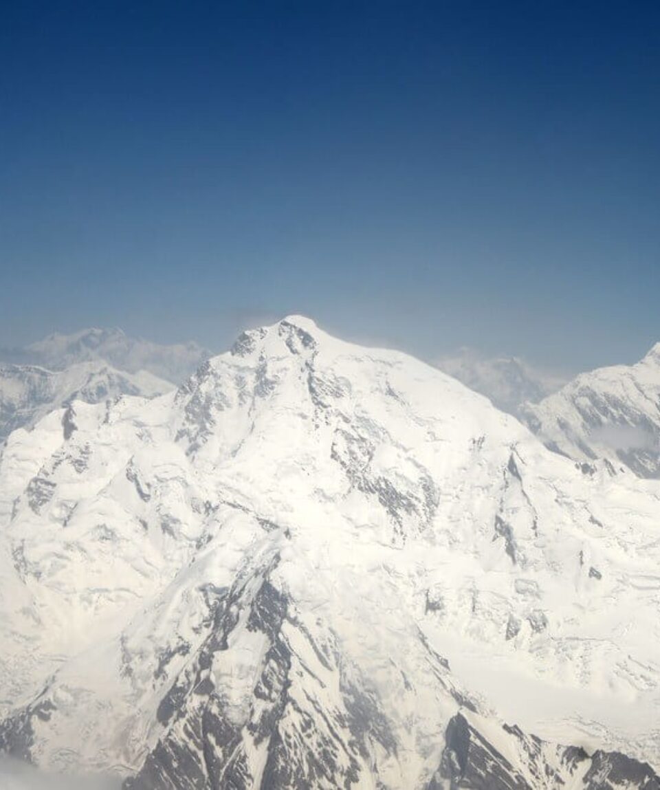
Kundyak and Donson Pass An link Bumboret and Upper Rumbur Gol, presenting Kalasha culture and breathtaking scenery.

  • Reviews 0 Reviews
    0/5
  • Vacation Style Holiday Type
    Camping, Climbing, Guided, Rock Climbing, Trekking
  • Activity Level Moderate
    3/8
  • Group Size Medium Group
    20
All about the Donson Pass and Kundyak An.

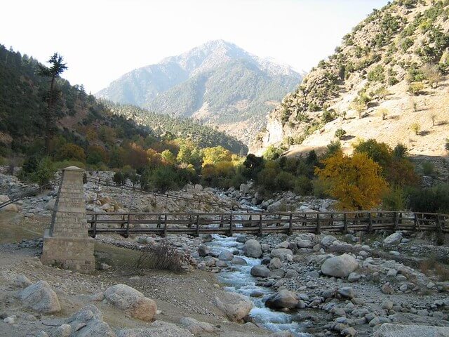
The journey from Bumboret to the Upper Rumbur Gol, which meanders through beautiful forests and lovely towns, is tucked away in Pakistan’s alluring Kalasha Valleys. The Donson Pass (2970 metres), the serene Acholgah Gol, and Kundyak An (2855 metres) are just a few of the attractions of this beautiful trail that immerses hikers in the Kalasha culture.

This trip, which starts in the town of Bumboret, takes place through a woodland road that not only reveals the natural beauty of the area but also brings visitors to the distinctive and vivid world of the Kalasha people, an indigenous community known for their unique traditions and customs.

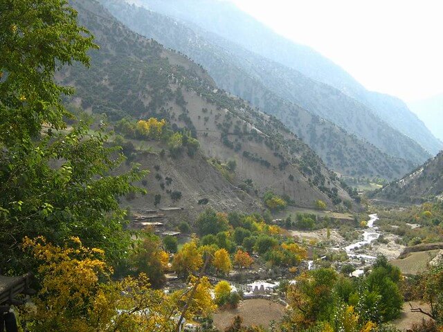
The Donson Pass, which serves as a turning point in this route and is located at an elevation of 2970 metres, offers trekkers expansive panoramic views of the surrounding regions. The untouched natural beauty that defines this region of the world can be deeply appreciated from this vantage point.

Travellers will come across the serene Acholgah Gol, which is tucked between the Kundyak An and the Donson Pass, as they continue their walk. All throughout the year, Kalasha men from the villages of Anish and Batrik live here and tend to their animals. A few Kalasha women work with them to cultivate their crops in the months of July and August.

It is advised for people beginning this trip to travel the route from south to north under the direction of experienced locals from Bumboret who are familiar with the area. Their knowledge guarantees a seamless and culturally enlightening experience.

Both Kundyak and Donson Pass provide a way to interact with the Kalasha population, see how they live, and be fascinated by the tranquil beauty that envelops this part of the world. An provides more than simply a walk. This voyage promises to leave indelible memories of an unforgettable expedition in addition to the splendour of nature and the warmth of human interaction.

  1. Day 01 Batrik to Gomenah

    Take the steep, firm, and clearly marked track as it ascends the gully behind Batrik (2040m). Pass through a forest of cedars and sporadic Chilghoza pines where there is obvious evidence of vigorous logging and milling. As an alternative, you can reach the path up from Batrik in two hours by walking from Krakal on the kinder, wider donkey trail that travels east and north.

    2.5 kilometers from Batrik, continue up gradual switchbacks on a wide trail for 45 to 1 hour to Donson Pass (2970m). Massive, magnificent cedars that are at least 1000 years old cap Donson Pass. To the east is a rocky pyramid named Gorasin, while to the west is a ridge covered in trees. On the grassy slopes to the north, cows and goats are grazing. While the Rumbur valley is buried by the Kundyak An ridge, Acholgah Gol is visible below. To the north, Tirich Mir and Noshaq are significant.

    Follow a track for 30 minutes as you descend north through meadows rich with flowers. Some of the cedars in this woodland have trunks that are 3 meters in diameter. A tiny gully may be found to the west of the Spur. To reach the gully’s true left side, cross it. Pass through a forest in five to ten minutes to reach Owzurie, a wooden shelter at 2460 meters. Continue descending for another 45 minutes while going high above the Donson Gol on a reliable trail, passing a side stream. Pass beneath Gogalog, a trail point and westward bend (2220m).

    Near a hot spring, Donson Gol and Acholgah Gol converge below. Views of Downvalley to the east are dominated by Ghariet Peak. The entire valley is covered in trees when one looks south along the Donson Gol; Gorasin is rising to the east of the pass, marking the road back to the pass. Two large cedars are located further to the north, just around the trail’s bend. From here, you can either descend to the fields below or continue on the trail for another fifteen minutes to reach the community of Shigala. Camp anywhere in the three communities of Passuwala, Shigala, or Gomenah (1980m), which is across the river and 3.5 kilometers below the pass. Acholgah Gol is crossed by several footbridges made of stone and logs.

    Three kilometers above the border police checkpoint, a route links the lower Rumbur Gol to the Acholgah Gol. Only when the water is low is the route open, and from May to July it is typically impassable. The Lachorsin peak rises to the east of Gomenah. It is known as Pushak (Snow Leopard Hill) in Kalashamun because of the snow leopard that is rumored to descend and raid the locals’ livestock. Acholgah Gol is a two-hour climb up to a mineral water spring.

  2. Day 02 Gomenah to Rumbur Gol

    After crossing the Acholgah Gol, continue walking 30 minutes north along the road till it ends (2460m). Ascend either the westward slope or the desolate hillside, which are both nearby crossings of the Kundyak An. On goat pathways, ascend the desolate hillside known as Kundyak for 15 to 30 minutes to reach a modest wooden shelter (2670m). To encourage bees to establish hives so Kalasha can get honey, notches were made into the branches.

    Continue for 1 to 2 hours up a logging scar that is 10 m wide. This strip eventually becomes a gully with deadwood scattered throughout. The trail suddenly vanishes, and the path to the pass climbs and turns to the right of the gully. The woodland floor provides Qutsi, or morel mushrooms, in May and June, and later, wild strawberries. Since it is covered in trees, Kundyak An (2855m) cannot be seen from below. The pass’s views to the north are blocked by vegetation. However, the wonderful sweeping views to the south towards the Donson pass. The 1.25 km ascent passes through an old-growth forest with 300–1000 year-old trees.

    Up until you arrive at the first settlement below in one to two hours, there is no clear track north of the Kundyak An. As the overgrown track appears and vanishes, having a local partner who knows the way down is crucial. In order to reach a Kalasha house and barley field at Narajau (2225m), 2km below the mountain, the road stays to the right and bears north-northeast. Traghdhur, a Muslim and Gujar village, is located across the valley. The Kalasha settlement of Ravelik is located far above where this tributary and Rumbur Gol meet. To the far north lie the fields of Shekhanandeh.

    The footbridge across the stream below Narajau is just a short drop away. On the first of eight footbridges (the number of footbridges varies depending on the level of the river), cross to the real left bank. The actual right bank is bordered by high rocks, and the stream flows into a gorge. Reach Rumbur Gol (2070m) after 30 minutes and multiple river crossings. Views of the Gangalwat Gol and the Afghan border may be seen to the west from the confluence. To access the road along the Rumbur Gol’s true bank, cross the river over a robust plank footbridge.

Package Confirmed Dates Trip Status Trip Status Price (PP) Excluding Flights Price (PP) Including Flights  
June 12, 2025 - June 17, 2025
Guaranteed
$800
N/A