gokhshal an and dooni an

Gokhshal An and Dooni An

from
$1,000

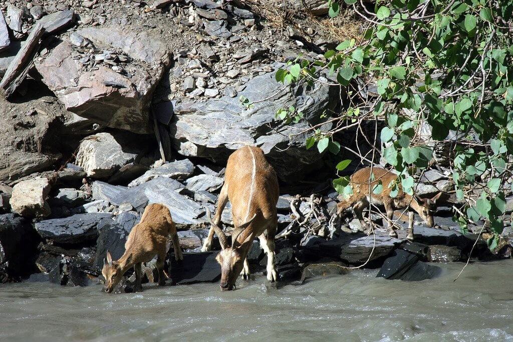
Gokhshal An and Dooni An are difficult mountain routes, noted for stunning Hindukush Peak vistas and the potential to sight the elusive Markhor.

  • Reviews 0 Reviews
    0/5
  • Vacation Style Holiday Type
    Camping, Climbing, Guided, Hiking, Trekking
  • Activity Level Moderate
    3/8
  • Group Size Medium Group
    20
All about the Gokhshal An and Dooni An.

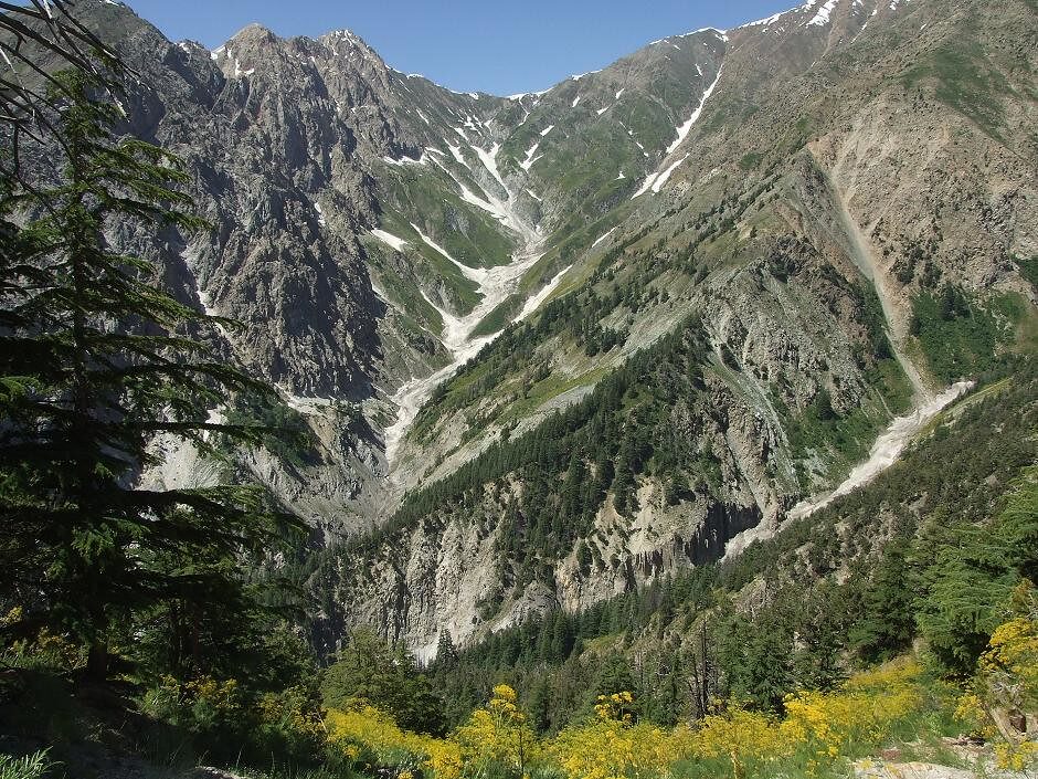
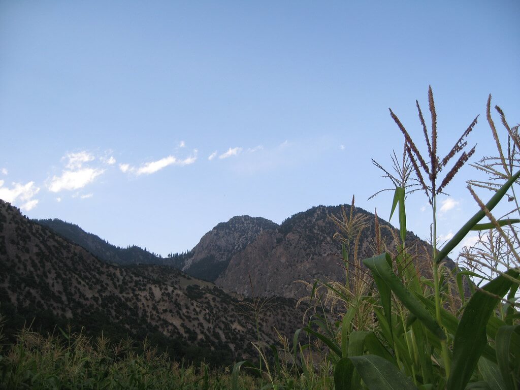
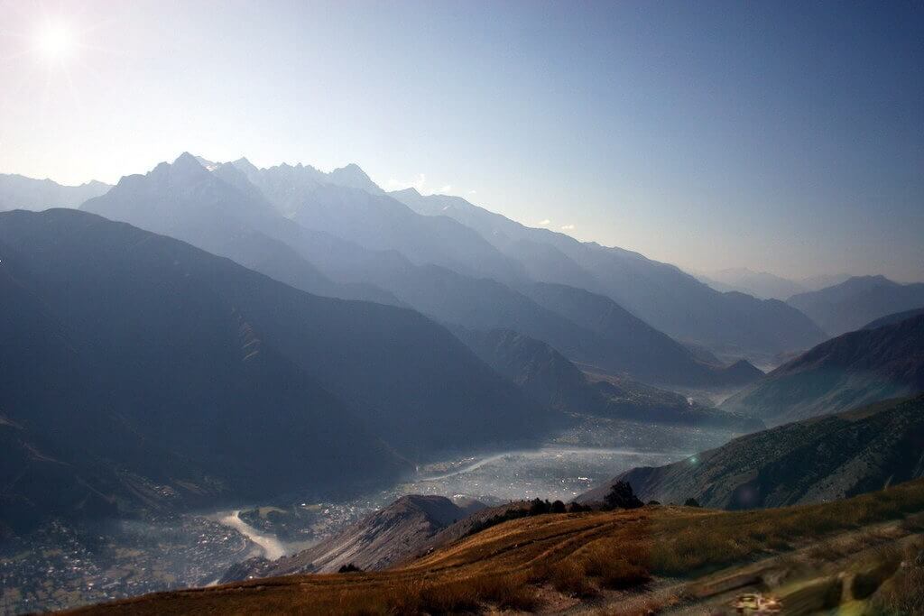
Gokhshal An and Dooni An: Trekking across the pristine landscapes of Chitral Gol National Park and into the enthralling Kalasha valleys in northern Pakistan is made exciting and difficult by the Gokhshal An and Dooni An trek. This well-known trek provides breathtaking views of Tirich Mir, the tallest peak in the Hindu Kush mountain range, as well as the exciting potential to glimpse the gorgeous markhor, a highlight for wildlife fans.

Two mountain passes must be crossed on this trek: Gokhshal An and Dooni An, which is also referred to as Chimirsan An in Rumbur. The voyage starts in the untamed and breathtaking Chitral Gol National Park, a refuge well-known for its rich species, including the imperilled markhor.

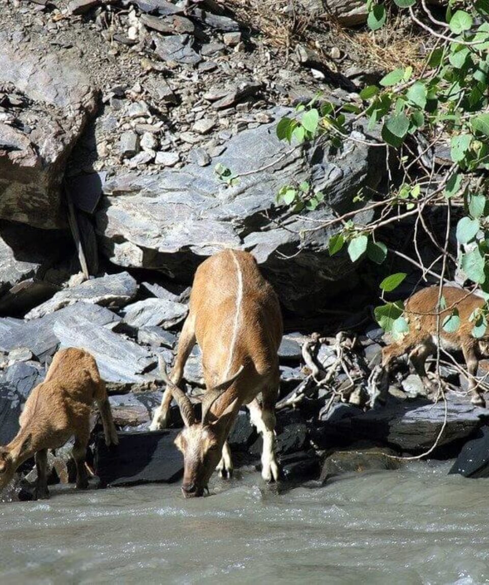
One of the rarest and most sought-after wildlife sightings in this area is the markhor, which is distinguished by its characteristic spiral horns. The walk provides a rare opportunity to see these amazing creatures in their natural habitat, and Chitral Gol National Park is committed to the preservation of this famous species. The significance of wildlife protection is emphasised by the intense and lasting experience of watching the markhor in its natural habitat.

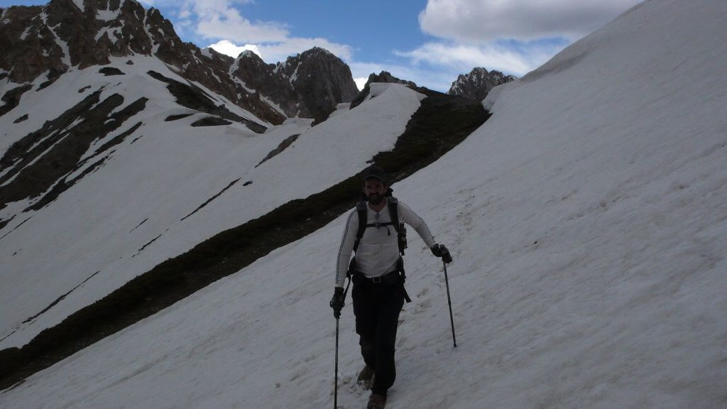
The difficult and frequently ill-lit pathways that take hikers across Gokhshal An and Dooni An are another draw to the trek. In addition to giving thrill-seekers an adrenaline boost, these rough passes provide beautiful panoramas of the neighbouring mountains. Throughout the trek, Tirich Mir serves as a constant companion and is especially mesmerising when it dominates the landscape.

In addition to the breathtaking views, this journey provides a great opportunity for birdwatchers and wildlife aficionados. Trekkers may come across different types of animals along the path, such as ibex and perhaps the rare snow leopard. The ability to see different avian species against the backdrop of the untamed countryside is further enhanced by the area’s rich birdlife.

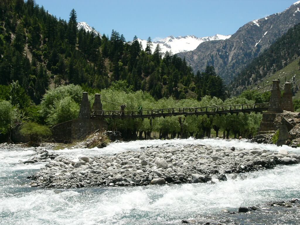
Beyond the natural splendours, the walk also presents visitors to the Kalasha Valley’s rich cultural legacy. The Kalash people, whose particular culture and way of life include vibrant festivals and peculiar customs, live in these valleys. The walk offers possibilities for cultural exchange and engagement with the local populations, giving travellers an inside look at these unique people’s customs and way of life.

The Gokhshal An and Dooni An trek is an extraordinary journey that skillfully combines the wonder of nature, the excitement of exploration, and the significance of wildlife protection. It welcomes people with an adventurous spirit to travel through the isolated and pristine landscapes of northern Pakistan, where the magnificence of the mountains, the attractiveness of the wildlife, and the depth of culture mix to produce a unique and unforgettable experience.

  1. Day 01 Chaghbini to Gokhshal

    Follow the trail along the south-facing side of the ridge at the head of the Ishperudeh stream from Chaghbini (2925m), passing a spring. (Avoid the ridge top trail, which connects to the simpler trail described here after a Class 3 traverse across a rock face.) When you reach the stony Ishperudeh ridge, turn up a green slope. The pass, which is the lowest point, is a tiny gap south of a bigger, higher saddle. Two hours from Chaghbini, ascend a cattle trail before passing the intersection with the Class 3 route on the right. In another 45 to 60 minutes, you’ll arrive at Gokhshal An (3720m), where you’ll enjoy breathtaking views of Buni Zom and the Lowari Pass.

    Reach the softer vegetated slopes 30 minutes below by carefully descending over steep, loose gravel switchbacks. After 10 to 15 minutes, pass a small spring, cross two small, clear streams, and then continue on the route above the true right bank of the second stream. After fifteen minutes, instead of continuing into the cedar forest, bridge a second tiny brook and proceed along its true right bank. In 30 minutes, arrive at the valley level. In another 30 minutes, take the route along the true left bank of the Gokhshal stream to the tin-roofed game-watchers’ home at Gokhshal (2650m). Walnut trees and a spring close to willows are nearby. 

    The property is located in a boulder region that is pine-forested and in an amazing rocky gorge that resembles an amphitheater. Sadly, there are cows nearby grazing, so the grass is all gone and there are poo mounds under the trees.

  2. Day 02 Gokhshal to Chimirsan Ghari

    Ascend the easternmost (first) of three forested spurs from the large ridge Separating the Gokhshal Gol and Dundini Gol after crossing the creek and moving west-south-west. A now-faint former bridle path leads southeast and contours up for an hour to the ridge top (3049m), which is due south of Gokhshal and is visible below. After descending for ten minutes, turn off the trail and proceed to the west and south (right) through a very faint game-watchers’ route.

    The primary entrance trail to Dooni Gol was destroyed by a slide. Take a 45-minute diversion to Dundini Gol (2772m), which is a good place to get some water and rest and is known locally as Chhato Ush (lake water). To reach a forested ridge, cross a log footbridge and climb steeply for about 20 minutes. To reach the stream, follow the true left (west) bank of the Dooni Gol for 30 minutes. To reach Dooni Ghari (3350m), ascend a grassy hill along its true right (east) side for 30 minutes after crossing it via a snow bridge, which is still in place even in the late stages of the season. For hikers traveling the opposite way, this area may make a good camping location due to a little spring tucked away among the willows.

    While passing small stone shelters next to boulders, continue to follow the remnants of the old trail as it rapidly ascends switchbacks high over the Dooni Gol’s true right (east) bank. The dim route is occasionally marked by a few small cairns. A prominent, isolated stand of five or six sizable cedars is visible from 100 meters away. After a brief ascent of a valley south of these trees, you will emerge onto a grassy ridge covered in juniper bushes. Tirich Mir becomes clearly seen. A further hour of switchbacking up the grassy, flower-covered hills and following livestock tracks will get you to Dooni An (3713m), the southern limit of the Chitral Gol watershed. Buni Zom is discernible in the distance, and Tirich Mir is magnificent. The markhor herds’ summer habitat is to the west, above the numerous feeder streams of the Dooni Gol.

    Descend and contour the east (left) side of the bowl below the pass starting at Dooni An. Aim for the northernmost point of the flat plain, where you may see herders’ huts on the Chimirsan Gol’s true right (west) side. To get to the point, take the middle Spur. One to 1½ and a half hours from the pass, cross the stream to get to the level area. The huts of Chimirsan Ghari (3100m), which are located along both banks of the Utak Gol, the stream that flows from Utak An (see Utak An under Other Treks), are only 15 minutes away, hidden behind the low Spur at the southern end of the plain. Goats are herded here by Kalasha and Muslim Rumbur and Uchust tribes. Camp on a grassy location with ample clean water that is gently sloped.

  3. Day 03 Chimirsan Ghari to Shekhanandeh

    Cross Utak Gol after 30 minutes of descent on an old lateral moraine. In to two hours, a steady descent through 500-year-old cedar forests and through little side streams brings hikers to the beginning of a canal close to the Baltum Hut (2762m) on the south bank of the Rodi Gol. Continue to descend for another hour, contouring through the forest above the true right (west) bank of the Chimirsan Gol to the Nuristani-style residences above the north bank of the Jajok Gol. Cross Jajok Gol and descend through cornfields along the spur separating it from Chimirsan Gol. After spending an hour far above the real right bank of Chimirsan Gol, the trail descends the slope dividing Chimirsan Gol and Rumbur Gol to reach Shekhanandeh (2250m), where the road begins. The Bashgali tribe’s Kati-speaking residents dwell in a settlement that was formerly known as Bashgaliandeh. The word ”shekh” is used to describe Muslim converts.

Package Confirmed Dates Trip Status Trip Status Price (PP) Excluding Flights Price (PP) Including Flights  
June 12, 2025 - June 19, 2025
Guaranteed
$1,000
N/A