lupgar pir pass

Lupgar Pir Pass

from
$1,200

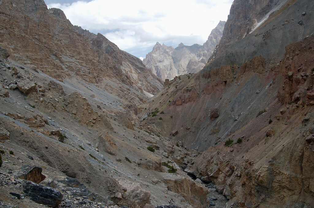
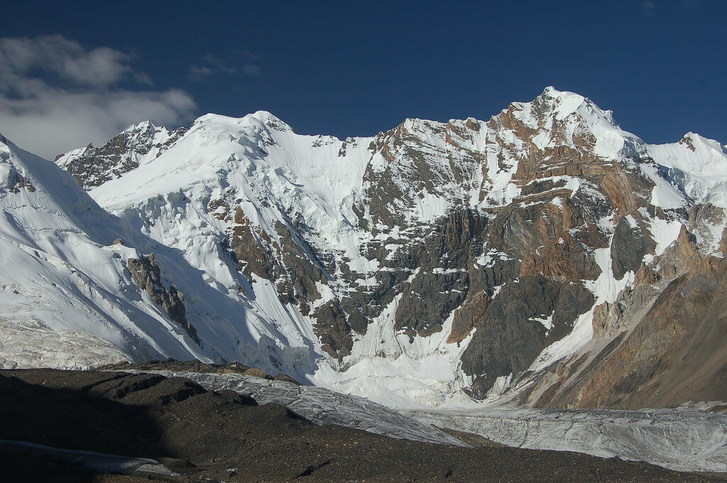
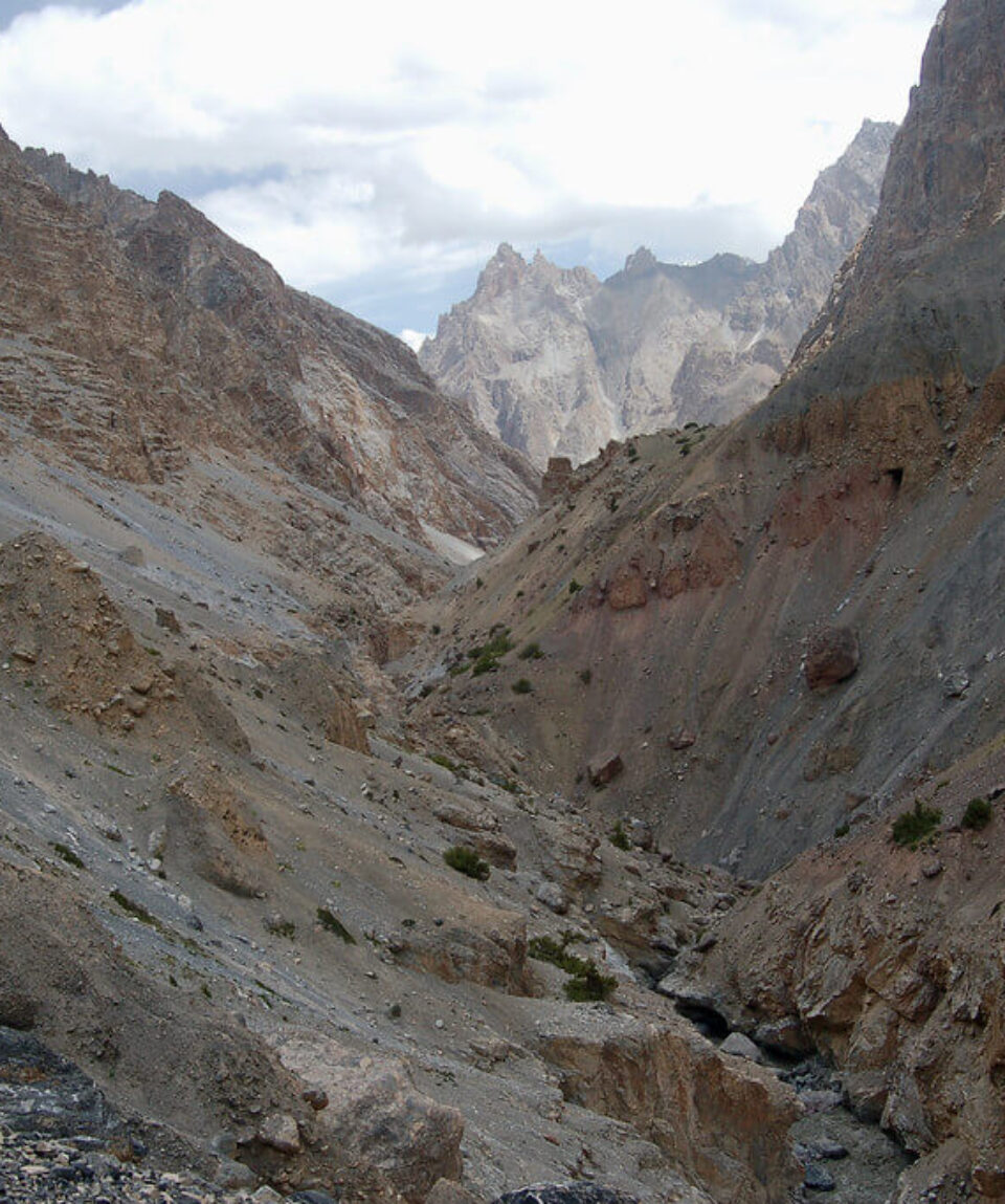
Lupgar Pir Pass: A less-traveled path between Yishkuk and Raminj that provides breathtaking views of the Tirich Mir range as well as a glance into the craggy Lupgar Valley.

  • Reviews 0 Reviews
    0/5
  • Vacation Style Holiday Type
    Climbing, Culture, Guided, Hiking, Trekking
  • Activity Level Moderate
    3/8
  • Group Size Medium Group
    20
All about the Lupgar Pir Pass.

The Lupgar Pir Pass is a well-kept secret that has long avoided the attention of hikers and explorers. It is located in the isolated and breathtaking Karakoram mountain range. With a lofty elevation of 5190 metres, this non-glaciated pass offers a journey unlike any other. It follows a path that parallels the Chapursan Valley’s southern boundary and connects Raminj in the mountainous, beautiful Lupgar Valley with the upper Chapursan Valley’s Yishkuk.

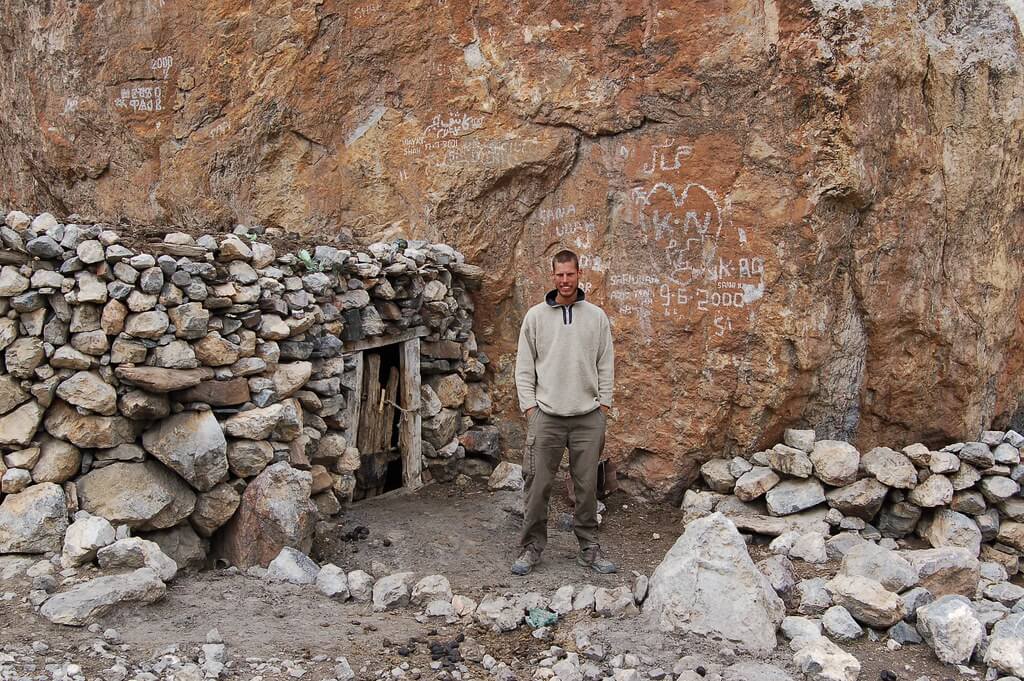
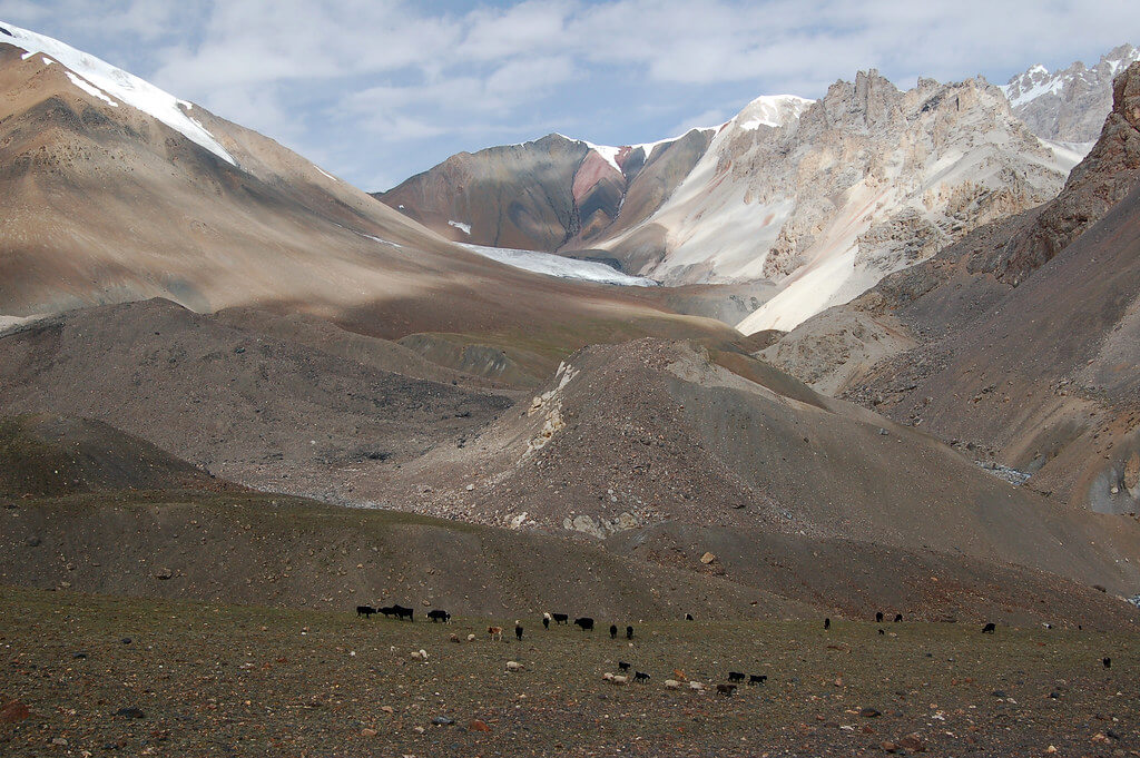
The indigenous populations in this area have traditionally used these valleys for grazing their cattle rather than for travelling via the pass. It wasn’t until 1994 that this path once again became a subject of exploration, effectively “reopening” it. The 1994 crossing, a significant event in modern history, revived interest in the past among both hikers and mountaineers by following in the footsteps of Schomberg’s inaugural expedition in 1934.

Lupgar Pir Pass offers two different routes for intrepid travellers to go across its stunning landscape. Due to the fact that Yishkuk is 300 metres higher than Raminj, the west-to-east route, starting in Yishkuk, provides for a more progressive acclimatisation process. Additionally, compared to the east side of the pass, the west side offers a quicker and less difficult ascent.

Non-technical glacier crosses, one of the trek’s distinctive features, give a thrill and a challenge to those who dare to set out on this trip. The Karakoram’s lasting fascination is attested to the Lupgar Pir Pass, which serves as an invitation to discover its untamed landscapes and intricate cultural traditions. It continues to be a secret gem, just waiting to be uncovered by people looking for the untainted beauty and untried adventures that the mountains have to offer. As the years go by, its attractiveness intensifies, solidifying its standing as a must-visit location for travellers who desire for the rush of the uncharted.

  1. Day 01 Yishkuk to Raud

    A well-watered meadow with some willows may be found in Yishkuk (3450 m). Just before you get to Yishkuk, where zolg (Berberis), with its tasty blueberries, and wild rose bushes are abundant, a good spring flows alongside the road. Before the route starts to climb towards the wooden bridge over the Yishkuk torrent, turn off the road. With the outwash stream of the Wyeen Glacier to the west and walking south up the valley through moraine debris. Along the trail, sparse junipers are seen. After 30 to 45 minutes, the trail makes a southeast bending turn and arrives at a level region with largely stands adjacent to a sizable, extremely cold, clear stream. The spring that feeds the stream is at the bottom of a scree slope that faces south. This location, Raud (3600m), makes a great camping location. The distinctive red rock known as Sekr, which has a summer hamlet at its base, may be seen to the west across the 20 km-long Yishkuk Glacier. Despite the fact that this is a very short walk, most hikers need to acclimatize before continuing their ascent.

  2. Day 02 Raud to Wyeen 

    To cross the two-part wooden footbridge that spans the wide glacial torrent, cross the clear stream and proceed five minutes along its true left side. To reach the huts and livestock enclosure at Kit-ke-zherav (3690m), ascent the tiny, clear herder’s trail 30 minutes above the river’s true left bank via junipers. It takes five minutes to travel from the south to the little Kit-Ke-zherav stream. After crossing it, continue 45 minutes further up the stony, narrow ablation valley to a side stream named Shot Dur (3780m; ”avalanche valley”). On the glacier, this is the last water source. In 45 minutes, you will reach a black talus slope by continuing up the valley and finally climbing out of it to contour the green mountainside. 

    In 15 minutes, traverse the gritty, black talus known as Charva Shui (3990m). Return to the ablation valley and continue to climb gradually for 30 minutes until the valley begins to twist to the south.

    A side valley characterized by red sandstone may be seen across the Wyeen Glacier to the east. The grassy meadow seen between two tiny ridges to the south of it is Wyeen camp. Spend two hours crossing the glacier. The glacier’s rock is mainly stable, making the crossing simple. Keep to the north (left) of two sizable tan and white debris piles in the glacier’s center. Only one or two tents and a few more on rooftops can be pitched at Wyeen (4100m). Greater trekking groups Camping beside the glacier stream that flows from Banafshayeen may be preferred. Just above the livestock pen, there is clear water.

  3. Day 03 Wyeen to Haji Beg Camp 

    Go straight across to the actual left bank of the Banafshayeen stream. Spend an hour climbing the lateral moraine of Wyeen Glacier on loose boulders. Walk along the stream’s side after leaving the moraine. Just below the mouth of the Banafshayeen Valley (4200m), cross to its true left bank. A small moraine lake and an open area close to it offer a potential camp spot for large trekking parties. To reach the level Banafshayeen Valley (4410m), climb 30 minutes to the east up the grassy slope. It’s breathtaking to see Kuk Sar (6943m) and its unclimbed 3000m vertical wall. The highest pasture used by Wyeen herders is called Banafshayeen, which literally translates to ”the place where banafsha (Primula macrophylla) grows.”

    There are no paths or cairns beyond this location. Continue gradually up the true right bank of the stream. The terminus of an unidentified glacier (4650m), which fills the valley, is located one hour above the Banafshayeen meadow. The Swiss map only depicts two tiny glaciers higher up the valley, not this glacier. The confluence of these glaciers’ outwash streams is indicated on the map below where the glaciers have combined and descended. On the slope high above its northern boundary, skirt the glacier. 45 minutes of walking over a black lateral moraine will bring you to a little side valley with a clear stream. A second side valley with a larger, clearer stream pouring down will be reached after another hour of hiking high above the glacier. The remains of a square enclosure adjacent to a sizable, noticeable boulder suggest that others have traveled this way. Ascend along this stream for five to ten minutes to reach the large flat region. This is Haji Beg Camp (4680m), which the authors named in 1994 in honor of their trip partner who personifies the spirit of these mountains. The pass can be seen at the head of this side valley, and the views are breathtaking.

  4. Day 04 Haji Beg Camp to Wyeen

    To get to the Lupgar Pir Pass (5190m), follow the stream for one to two hours to the northeast until you reach its head (5100m). By mid-July, the pass is typically snow-free. Beyond Kuk Sar, to the southwest, lies Pamir Sar (7016m), which Schomberg characterized as ”a series of superb peaks and glaciers.”

    Follow a scree knoll to the left and descend steep, loose scree before crossing it to reach a glacier. It takes 15 to 30 minutes to descend 300 meters. Zigzagging your way out onto the white glacier can help you avoid crevasses. Work across the glacier’s 15 to 20-degree slope and slightly downward for 30 minutes to a thin black medial moraine. Onto a terminal moraine with a few pools, continue after it. Additional ponds are seen around 500 meters below the glacier’s tip. Stay high and travel right on scree, well above the river, for 30 minutes to reach a clear stream and another 15 minutes to reach Wyeen (4530m), a grassy yak pasture. Rather than descending towards the mouth of the river.

    The red, yellow, and brown rock formations in the upper Lupgar Valley are particularly spectacular. The snow-covered, 6000-meter peaks at the valley’s head may be of interest to climbers because they seem to have simple ascents.

  5. Day 05 Wyeen to Hoopkerch

    Pick up a thin track as you descend to the main riverbed. Reach the sizable outwash stream from the massive glacier to the south in 15 minutes. Its numerous knee-deep canals Ford. Continue for a further hour across the stream to Ilga (4380m), a grassland with a few abandoned huts. In the late afternoon, the water from a hanging glacier is particularly silty. On the north side of the valley, there are stunning snow-capped spires with scree flowing down to the river from their base. Fantastic red crags can be found on its southern side.

    Go 20 minutes down to Ghorhil, a natural livestock enclosure in the middle of a boulder field. Silty water is present. Spend 15 minutes descending to a river from the south through jagged boulders. To reach Lupgar (4140m, ”big rock”), the primary summer residence for the Khaibar and Raminj herders who share pastoral rights in this region, cross the river. At the bottom of a cliff to the south is a little spring. Keep to the cliffs as you leave Lupgar. After traveling 15 minutes from Lupgar to a southern side stream via a stone footbridge, descend following the stream’s true right bank for 30 minutes to reach the Lupgar River. Two-thirds of the way down, on the left, is a large spring that provides the final reliable source of pure water before Raminj.

    Follow the path along the real left bank of the river past Khuda Khair Charjeshan, or the ”God help us slides,” and cross the river on an impressive footbridge. The trail is extremely exposed and narrow, and rock fall along this portion is fatal in the wind or rain.

    The walk reaches a natural footbridge 45 minutes later. The river below is hidden by the gorge’s depth and narrowness. Continue on a narrow, unsteady trail with a perilous footbridge after crossing the true right bank. Cross two side streams as you continue down the valley. One has crimson water, whereas the other has whitish water. After an hour-long descent to a sandy riverbank area through a birch grove, ascent is required to reach a juniper forest. Hoopkerch (3700m, ”seven hunters’ huts”), where a glacier side stream enters from the south, is ahead and below 15 minutes. The cattle pen lies underneath a little spring.

  6. Day 06 Hoopkerch to Raminj 

    Harkeesh (3489m, the ”place cultivated with a plough”) is an hour away through a stunning old juniper forest after crossing the footbridge over the muddy stream. The lone Burushaski place name in the valley is Harkeesh, given by Burusho from Raminj who attempted to cultivate here. Kishtazod is Harkeesh’s Wakhi name. A large, open expanse of grass surrounds the sturdy house and livestock corral, making it the ideal location for a camping spot. The cliffs that the canyon walls ascend to are topped with turrets, spires, and massive, multicolored rocky summits. This is where the trail from the Werthum Pass ends (see p). The side stream’s water may be muddy. After 10 minutes of steep descent from Harkeesh, cross a side creek on a footbridge. In this region known as Furzeen (Purzin on the Swiss map), birches, roses, tamarisks, and junipers thrive. Continue walking for another five minutes until you reach the left bank of the Lupgar River. The trail is much better from here to Raminj, though it is still exposed in some parts. The trail continues high above the river gorge for the following 114 to 112 hours, occasionally dipping closer to the river. At the halfway point, cross a footbridge to the real right bank of the Lupgar River, which leads to the Dior cabin. To reach Raminj, take the path along the willow-lined canal for an hour, passing a number of gushing springs along the way. The canal, which was started under Mir Muhammad Jamal Khan’s rule and finished in 1978, is an engineering marvel. The canal is carried beneath scree slopes and the trail passes through a number of tunnels carved out of the cliff. Raminj (3095m), which is located above the meeting point of the Lupgar and Chapursan rivers, is a lovely, well-kept village with an east and south orientation.

Package Confirmed Dates Trip Status Trip Status Price (PP) Excluding Flights Price (PP) Including Flights  
June 12, 2025 - June 21, 2025
Guaranteed
$1,200
N/A